Devon · TQ12
Aerial photography and video in Newton Abbot
A former railway town on the flat floodplain where the Teign turns tidal, Newton Abbot's biggest change today is new housing, exactly what aerial photography is built to sell.
A flat town ringed by hills, growing outward
Newton Abbot sits differently to the steep estuary towns nearby: it is built on the flat floodplain where the Teign becomes tidal, ringed by hills, with the ornate Victorian railway-era town centre and its large stock of terraces at the middle of it. The town's shape from above is not a single dramatic climb but a spread, and that spread is where most of the interesting activity now is.
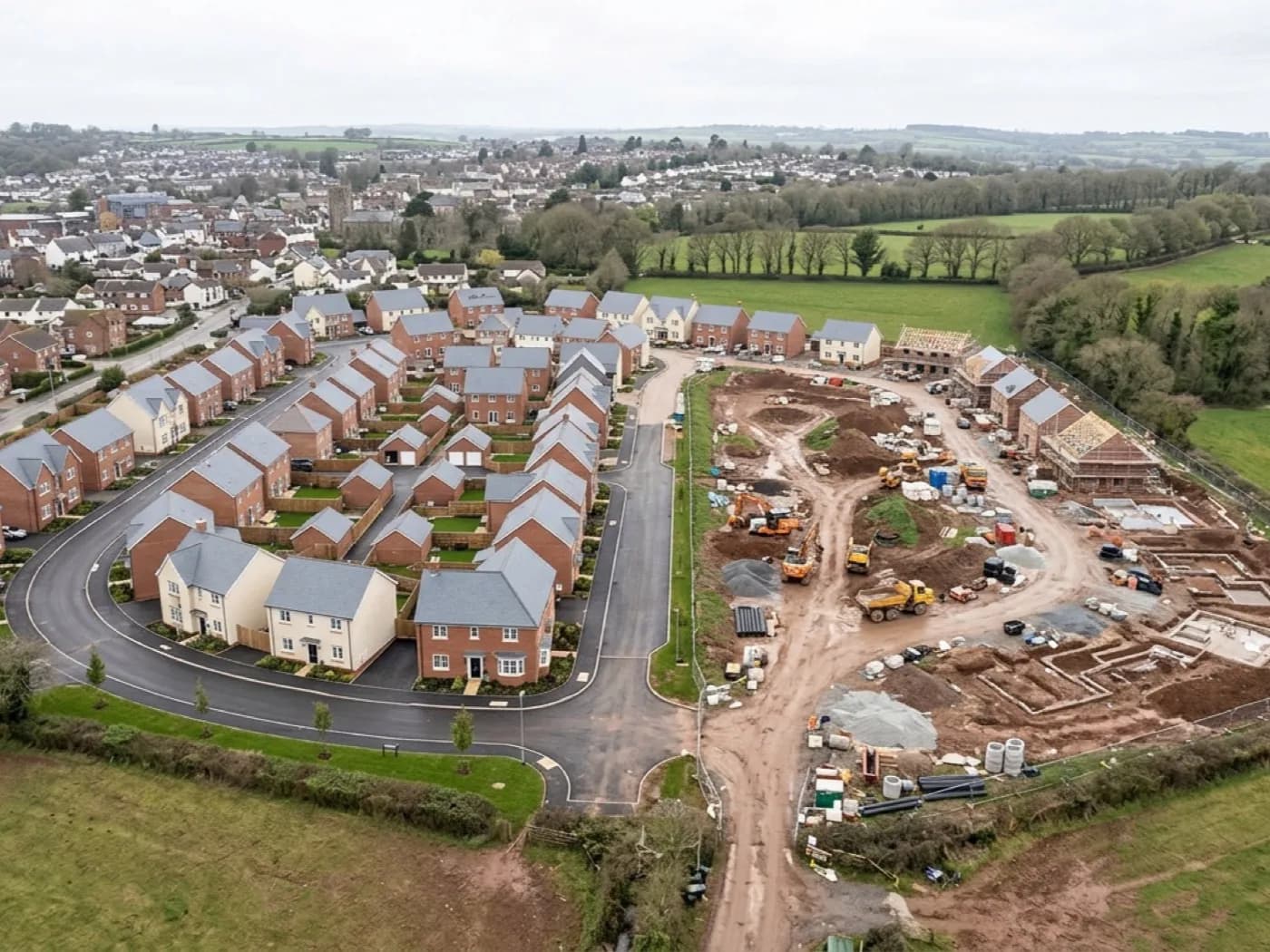
Substantial modern development at Houghton Barton and Wolborough, alongside extensive post-war estates, means Newton Abbot is one of the fastest-changing towns in this part of Devon. New streets, new junctions and new green space appear year on year, and none of that growth is easy to show from a camera held at head height on site.
To the north-west, the Bovey basin's clay workings have shaped this part of Teignbridge for generations, and Newton Abbot's position between Exeter, Torquay, Teignmouth and Dawlish makes it a natural hub for a photographer covering several coastal and inland bookings from one base in a single day.
Developers, a racecourse, and a growing estuary town
Developers marketing a new housing scheme need aerial photography more than almost any other local buyer: a single image showing plot layout, road access, proximity to the town centre and how a development sits against the surrounding countryside does the work that a brochure full of ground-level render shots cannot. Progress photography through a build, taken from the same angle at each stage, is its own useful record for a developer as much as a marketing asset.
Newton Abbot Racecourse is a second, quite different local buyer: a large venue that reads best from above, showing the course, the stands and the scale of a race day in a single frame. Stover Country Park and the Teign estuary give walking, leisure and nature attractions in the area a similar opportunity, and hotels near the racecourse or the estuary can use the same kind of imagery to show their setting.
The contrast between the ornate Victorian railway-era streets at the centre of town and the newer estates on its edges is itself worth showing: two very different kinds of housing stock a few minutes' flight apart, useful for anyone marketing the town as a whole rather than a single development.
A working, low-lying town
Newton Abbot is low-lying and often misty off the Teign, which mostly matters here for timing rather than access: a clear morning after mist has lifted gives sharp, well-lit shots of the estuary and the town, while flying straight into low winter mist wastes a booking. The town is less wind-exposed than the coastal towns nearby, though the estuary can funnel a stiff easterly through in winter.
The former Great Western railway works, part of the town's identity for well over a century, sits alongside the newer development as a reminder that Newton Abbot has reinvented its built environment before, and its current wave of new housing is simply the latest version of that.
A racecourse operating on flat land beside the town is unusual for Devon, where ground of that size is rare, and race days bring exactly the kind of scale and movement that a static ground photograph cannot show. Stover Country Park's lake and woodland sit close enough to the newer estates at Wolborough that a single flight can cover a housing development and the green space marketed alongside it in the same session.
Behind every shoot
What Newton Abbot clients are actually buying
CAA registered
Operator ID and Flyer ID held, plus the A2 Certificate of Competency. Every flight is planned to the rules that apply to the site, and the paperwork is available before the visit if your agent, venue or planning team wants it.
100 megapixel camera
A DJI Mavic 4 Pro with a Hasselblad camera and 6K video. The resolution is what lets a still be cropped hard for a brochure detail shot and still hold together on a large screen or in print.
Edited and licensed
Images are colour graded and cropped before delivery, not sent raw off the card. Every set comes with a licence for your own use, so you are not paying again to put the photograph in a listing or a campaign.
Insured with Coverdrone
Full commercial cover for the operation. Certificates go to agents, venues and marketing teams as a matter of course, without anyone having to chase for them.
Nearby
Also covered around Newton Abbot
- TeignmouthTeignmouth pairs a Georgian seafront with a working harbour and a red sandstone headland across the estuary mouth, giving aerial photography two contrasting towns in a single flight.
- TorquayTorquay is built across seven hills around a sheltered harbour, giving its grand villas, hotels and marina a layered, terraced backdrop that a ground photograph can never fully show.
- TotnesTotnes climbs from the tidal limit of the Dart to a Norman castle at the top of a steep high street, with the Dartington Hall estate's parkland close by giving one booking two subjects.
- ExeterAerial photography of Exeter's cathedral skyline, riverside quays and expanding eastern suburbs, for estate agents, developers and businesses across the city.
- DawlishDawlish sits in a narrow valley behind Brunel's sea wall railway, with a nature reserve at Dawlish Warren and cliff-top houses that all trade on the same uninterrupted sea view.
See what is included
Get a quote in Newton Abbot
Send the location and what you need photographed. Sam Hembury will come back with a fixed price and the next slot that suits the light.